A few years back, I read Snowshoeing through Sewers by Michael Aaron Rockland where the author participates in several urban outdoor adventures in New York City, New Jersey, and Philadelphia. This includes walking the length of Broadway in Manhattan which I duplicated in 2005. I wanted to conduct a similar outing in Boston and could think of no better road than Washington Street. This historic corridor was the only street connecting colonial Boston to the mainland in Roxbury via the narrow Neck. In 1788 the road was renamed in honor of George Washington. In tribute to the general and president, streets that cross Washington Street tend to change their names as they cross, with a few exceptions such as Massachusetts Avenue. I believe it is the longest street in Boston’s city limits or at least the longest street without a name change. Beyond Boston, Washington Street continues onwards to Providence, RI. In colonial times it served as part of the Boston Post Road and in the early twentieth century it was part of Massachusetts’ first state highway.
More photos from the walk online at Othemts.com!

It turns out that in my life I’ve actually walked most of Washington Street at some point with the exception of two sections. The first leg from the Dedham border to Roslindale was entirely new to me as I’ve never even been to West Roxbury. The section between Egleston Square and Dudley Square was also new territory to me and not coincidentally this was the most run down and desolate section of Washington Street. It’s great to follow a street like this for its entire length and experience the disparate and historic neighborhoods it passes through. A walk on Washington Street takes one through West Roxbury, Roslindale, Jamaica Plain, Roxbury, the South End, Chinatown, the Theater District, and downtown Boston’s historic core.

Independence Day seemed as good a day as any to walk the length of a road named for an American patriot. Susan and I took the Orange Line to Forest Hills and the 34 bus down Washington Street from there to the Dedham line. The bus actually said “Dedham Line” as it’s destination, but the bus driver didn’t kick everyone off where we got off so maybe it actually goes on to the other end of Dedham. So we got off the bus and walked back the way we came. Not too long into our journey we passed one of the famed Boston landmarks, a Dunkin’ Donuts franchise. We counted 9 Dunkin’ Donuts along the 8.8 mile walk which seems actually surprisingly few for Boston, especially since 2 or 3 of them while visible from Washington did not actually front the street itself. The first leg of the walk featured auto repair shops and car dealerships with a sprinkling of strip malls. Yet parts of the walk felt surprisingly rural. Off Washington were some barely-paved dead end streets with rustic wood frame houses and part of the street is framed by the wilds of Stony Brook State Reservation.

Entering Roslindale we passed children playing on a large inflatable water slide on their driveway. A friendly neighbor greeted us and asked about our plans for the Fourth. Many Bostonians seemed to spend the day doing home repairs such as painting and bricklaying as opposed to the traditional Independence Day grilling. Descending a hill we had our first view of Boston’s skyline in the distance. At Roslindale Square we stopped for very satisfying slices of pizza, properly spiced with a crispy crust. The pizza joint mysteriously has an autographed photo of Ty Cobb. Further along we came upon the Puritan Ice Cream factory but could not figure out where to buy some ice cream, if the general public can actually get some there.

The next leg of the journey begins at Forest Hills, where we boarded a bus about an hour or so earlier. Washington Street is actually split here and we walked along a stretch of road called New Washington Street under the Arborway overpass where the old terminus of the Green Line E Branch still seems to wait for a trolley to roll in. A large MBTA bus yard dominates when we rejoin Washington Street, but eventually we pass it and enter into the mix residential and commercial neighborhood of Jamaica Plain. We’ve been here a lot lately since we’ve been looking to buy a home here so it’s feels like familiar territory. Jamaica Plain haunts like Doyle’s Cafe and Canto 6 are quickly becoming my favorite pub and bakery. Jamaica Plain historically served as the center of brewing in Boston. One massive building on our walk that houses a personal storage rental place, and looked to me like a former armory, was marked as the home of Franklin Brewing Co., 1894.

Entering Roxbury, we walked along a stretch of road with low-income housing, abandoned buildings, rusty chain-link fences and most eerily of all, very few people in site. It was a pleasure to arrive at the bustle of Dudley Square, the commercial and social hub of Roxbury. We took in the landmarks such as the Haley House Bakery Cafe, an old furniture department store with faded advertisements painted on its exterior, and the building where Susan’s co-worker lives over a tattoo parlor (cool pictures in the window of the tats). We took a break in the box seats at Jim Rice Field, a recreational baseball field modeled after Fenway Park. A man on the field asked us how far we thought a mile would be if he ran around the entire field. We all agreed that about five times would do it and he set off to chug around the grounds in the summer sun and dust.

Things became decidedly more upscale as we entered the South End. We were impressed by the large brownstone mansion known as the Allen House. I was also pleased that the TV repair shop with it’s gaudy signs is still in business across the street. I remember reading in the Boston Globe several years back that haughty South End newcomers wanted to close this old store because it didn’t fit in their Yuppified plans for the neighborhood. On a side street we saw a small park with a lot of sprinklers, but sadly we could not run through as it was gated and locked. We were reminded of the date by the frequent lighting of firecrackers in the Franklin Park area. They echoed off the stone and brick in a cacophony of explosions. To Susan’s delight, we also passed a large cookout, so at least some people realize that you don’t spend the holiday repairing your house.

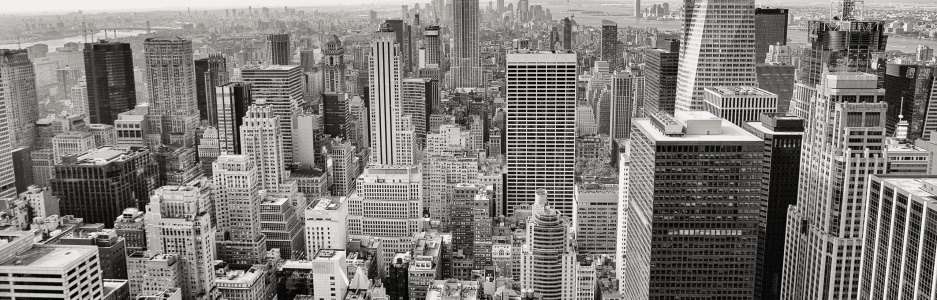
The last part of the walk was less remarkable, probably because we walk around downtown quite often. I took photos of a lot of the landmarks in the area but they were less of a revelation than the rest of the walk. We did find a nice tiered park by Tufts-New England Medicine Center to rest our dogs a bit and watch pigeons do their mating dance. One nice thing to think of as we walked through the throngs of shoppers and tourists is that likely none of these people had walked from Dedham nor did they know that we came that way by foot. We spent the last few blocks trying to find a restroom and a place to get refreshment with no success, so our walk ended rather anti-climatically at the toilets in the National Park Service Visitors Center. We weren’t up to continuing past City Hall to North Washington Street, but instead had a nice lunch at the Kinsale while listening to the rock and roll performances at the Cape Verde Independence Day celebrations across the street.
Next up: walking Massachusetts Avenue from Lexington to Dorchester!

You were very polite not to mention that the nearly 9-mile walk caused your pregnant wife to swell up like a a giant walking water balloon and become very, very bitchy. Washington St. reminds one of how hilly Boston is — particularly the granite and pudding stone outcroppings in West Roxbury/Roslindale/JP/Roxbury. I think that the desolate section in Roxbury was due mostly to it being the auto shop section of Boston.
LikeLike
A local blogger named Evan walked the entire length of Boston’s Emerald Necklace and put up a snazzy photo essay. This is a walk I’ll need to do some day. I think I’d start at Boston Common and finish at our soon-to-be home.
LikeLike
Nice blog…I grew up in West Roxbury and as a kid walked Washington street into downtown as well…
Gives a great view of what Boston really is- as ou hit a lot of different neighborhoods…
I live in London now-but man do I miss my hometown!!
Thanks again
James
LikeLike